THE PROJECTInspired by a semester studying at Bowdoin College's Coastal Studies Center, this project aims to give a sense of the variety of ways in which residents use the Harpswell waterfront. These works are the result of a summer collecting stories and experiences from Harpswell's coast. Though not exhaustive, the pieces include profiles of residents, my experiences on the water with them, and my own thoughts from around Harpswell.
How to use this website: This work is meant to be read similarly to a book. The pieces are ordered so you can read through in one journey around Harpswell. Scroll through each page. At the bottom of each page click the first button for the following page in the sequence of stories. The main island pages are a table of contents for the stories in their area. You can also navigate among the main island pages using the bar at the top. Additional note: If viewing on a large screen, I suggest making the window relatively small so the lines are shorter and easier to read. |
|
HARPSWELL, MAINE

216 Miles of Coastline
1 Peninsula - 3 Large Islands - >200 Small Islands
1 Peninsula - 3 Large Islands - >200 Small Islands
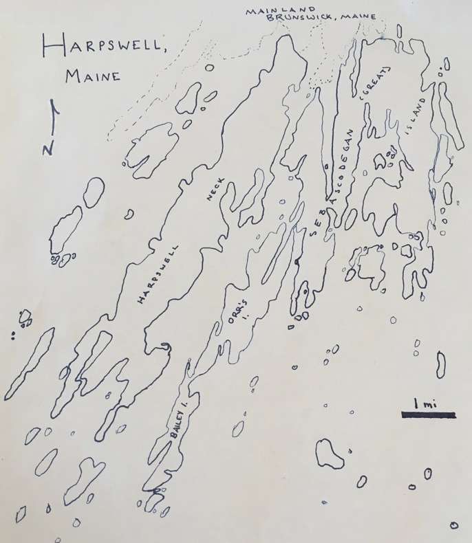
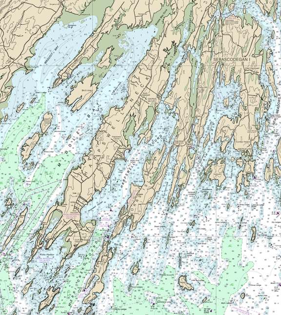
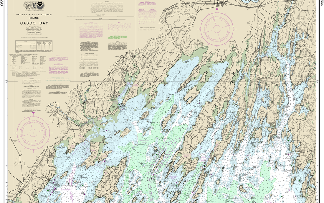
At forty three point seven degrees North and seventy degrees West is a border where water meets land. This spot, halfway up the North American continent’s eastern coast is where the Atlantic Ocean sloshes deep into narrow canals dredged out by glaciers years ago. This spot is Harpswell, Maine.
Harpswell is not one land mass like most towns, but rather a collection of rocks rising above sea level united by a name. Harpswell is dominated by a few fingers reaching out into Casco Bay with many islands dotting the waters off their fingertips.
Cape Elizabeth is Casco Bay’s southernmost corner with the major city of Portland dominating the western coast. Islands such as Peak’s Island, Long Island, and Chebeague Island make up the majority of land within the western part of the bay. Deepest in the bay are Freeport and Brunswick. The Phippsburg peninsula provides the bay’s eastern border, protected by Popham Beach at the eastern tip. The entirety of the land within Casco Bay’s eastern waters is Harpswell.
It appears that Harpswell is several peninsulas and dozens of small islands, though in reality, all land but Harpswell Neck is island. Before bridges were built, the only way to get to Sebascodegan (Great) Island, Orr’s Island, Bailey Island was by boat. Now, bridges connect everything, making much of Harpswell more accessible, though the islands still maintain their small communities.
We have spread to these islands. Are we feeding compulsory needs to expand, conquer, and work less? Now, driving a car over the bridges, these large islands are no longer islands, but simply part of the land. Have they lost island culture? Did they ever have small island culture before, given that they were already so large and near shore?
If the land reaching into Casco Bay is a hand with Brunswick at the palm, then Harpswell makes up three of the five fingers. Wolfe’s Neck in Freeport to the west would be the fat thumb and Merepoint Neck in Brunswick would be the small index finger. Then, Harpswell Neck would be the long middle finger, reaching farther out than any of the others, with Orr’s and Bailey Islands forming the ring finger. If you really let your imagination go, the bridge to Orr’s Island from Sebascodegan Island could be a ring, right at the base of the peninsula. The rest of Sebascodegan Island to the east would form the stubby pinky finger. In some ways, it’s even fitting that Orr’s and Bailey Island peninsula is directly connected to Sebascodegan just as the ring and pinky finger share tendons. In fact, the ring finger is the least independently mobile finger, just as Orr’s and Bailey rely on that coming from Sebascodegan Island for land transport from the mainland.
Click below to begin the journey around and through the heart of what makes Harpswell the amazing place it is.
